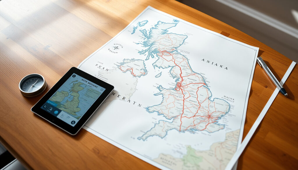
Map of the UK – Political, Road & Digital Maps Guide
From political outlines to road networks, printable PDFs to interactive digital tools, a good map of the UK can serve many purposes. Whether you need a blank template for a classroom, a detailed county map for a project, or simply a reliable navigation app, understanding what is available and where to find it makes all the difference.
What Types of UK Maps Are Available?
Political Map
Shows countries, capital cities, and major towns.
Road Map
Detailed roads and motorways for travel planning.
Printable Blank Map
Free PDF with country outlines for educational use.
Digital Maps
Interactive tools: Google Maps, Google Earth, Bing Maps, Tube map.
Key insights
- The UK comprises four countries: England, Scotland, Wales, and Northern Ireland – any accurate map must show these distinct boundaries.
- For travel, road maps (e.g., AA) or Google Maps with traffic layers are best; for geography, administrative boundary maps (OS, geoportal.statistics.gov.uk) are most reliable.
- Printable blank maps are widely used for teaching; best PDF sources are from Twinkl and educational sites – but check copyright.
- Digital maps like Google Earth provide 3D terrain, while Google Maps Street View offers ground-level exploration – essential for virtual travel.
Quick facts about UK maps
| Feature | Details |
|---|---|
| Capital City | London (51.5° N, 0.1° W) |
| Area | 242,495 km² |
| Highest Point | Ben Nevis (1,345 m) |
| Major Rivers | Thames, Severn, Trent |
| Number of Counties | England: 48, Scotland: 32, Wales: 22, NI: 6 |
| ISO Codes | GB / GBR |
| Time Zone | GMT (UTC+0), BST (UTC+1) |
Among the many formats available, Editable digital UK maps stand out for their flexibility. They come in Adobe Illustrator, PDF, SVG, CorelDRAW, DWG, and DXF – “high detailed,” “editable,” and “printable,” according to one provider. These products often include road and street maps, blank maps, county lines, buildings, land use areas, major roads, and residential streets.
Which Digital Map Service Is Best for the UK?
Users looking for an interactive experience have several options. Google Maps is widely used for driving directions, traffic updates, and Street View. Google Earth offers 3D terrain and satellite imagery. Apple Maps, after early missteps, has improved significantly. Bing Maps provides an alternative with bird’s-eye views. For London specifically, the official Tube map from Transport for London is essential for navigating the Underground.
For up-to-date road information, Google Maps updates continuously, while printed maps may become outdated quickly. Always check the data date when using any digital map for navigation.
If you need a custom map that you can colour, label, and download as a high-quality image, the Custom UK map tool from MapChart is a free, easy-to-use option. It fits both digital and printable use cases.
It is worth noting that the search results do not provide detailed comparisons of Google Maps, Apple Maps, and Bing Maps specifically for UK travel. However, based on common usage, Google Maps remains the most popular for road navigation, while Google Earth is preferred for geographic exploration.
Using Google Maps Street View in the UK
Street View is available for most of the UK’s roads and many footpaths. It can be accessed directly through Google Maps or the Street View gallery. This tool is particularly useful for previewing routes, checking parking, or exploring unfamiliar areas before a trip.
The London Tube map
The official TfL Tube map is the authoritative source for London Underground lines, station connections, and travel zones. It is available as a PDF download and on the TfL website.
How Is the UK Divided on a Map?
Understanding the UK’s administrative divisions is key to reading any map of the region. The United Kingdom is a sovereign state made up of four constituent countries: England, Scotland, Wales, and Northern Ireland. Great Britain is the island that contains three of those: England, Scotland, and Wales.
Countries within the UK
Each country has its own capital: London (England), Edinburgh (Scotland), Cardiff (Wales), and Belfast (Northern Ireland). On a political map, these are shown with distinct borders and symbols for capital cities.
Counties and administrative areas
The number of counties varies: England has 48 counties, Scotland 32 council areas, Wales 22 unitary authorities, and Northern Ireland 6 counties. It is important to note that county boundaries have changed over time – the latest official boundaries were published in April 2023 by the UK’s Geoportal.
County boundaries in the UK have changed, most recently in 2023. Always verify the date of a county map to ensure you are using current administrative divisions.
Major cities shown on UK maps
Beyond the four capitals, maps typically label Birmingham, Manchester, Liverpool, Glasgow, Leeds, Sheffield, Bristol, Newcastle upon Tyne, Cardiff, and Belfast. Smaller towns and villages are often omitted from low-scale maps but appear when zooming in on interactive digital maps.
Timeline of UK Map Development
- – Ordnance Survey produces first detailed UK maps.
- – Digital mapping begins with CD-ROM atlases.
- – Google Maps launches, including UK coverage.
- – Google Street View starts in the UK.
- – Apple Maps introduced (initially with errors in UK).
- – Geoportal publishes new administrative boundaries (counties and unitary authorities).
- – Ongoing updates: real-time traffic, 3D imagery, AI-powered route recommendations.
Established Facts and Grey Areas in UK Mapping
| Established information | Information that remains unclear |
|---|---|
| The UK consists of four countries; boundaries of countries are fixed and widely agreed. | County boundaries have changed over time (e.g., 2023 updates). Always check the date of a map for current administrative divisions. |
| London is the capital of the UK and England. | The exact definition of “state” vs “county” – the UK does not have states; users sometimes confuse this with US terminology. |
| Ordnance Survey is the official mapping agency for Great Britain. | Which digital map offers the most up-to-date road information – Google Maps updates continuously, while printed maps may be outdated. |
What Drives People to Search for a UK Map?
Users searching for “map of the UK” have diverse needs: from a quick political overview to a high-resolution printable PDF for a school project. Search engine results pages lean heavily toward static political maps or specialised government data, leaving a gap for a single resource that curates all major types. Seasonal spikes occur before school terms (printable maps) and holiday travel periods (road maps). Digital map platforms dominate mobile searches, while “printable PDF” queries peak on desktop.
Sources and Authoritative References
The official mapping agency of Great Britain, providing highly accurate maps.
Ordnance Survey (os.uk)
Counties and Unitary Authorities (April 2023) Map in the UK – official administrative boundaries.
UK Office for National Statistics (geoportal.statistics.gov.uk)
United Kingdom Map – political and physical overview, satellite imagery.
Geology.com (geology.com)
Summary: Finding the Right Map for Your Needs
Whether you need a political map, a road map, a printable blank PDF, or an interactive digital tool, the UK offers a wide range of map resources. For editable, print-ready vector maps, explore Editable digital UK maps. For custom interactive maps, use the Custom UK map tool. Always verify the publication date for county boundaries and rely on official sources like Ordnance Survey and the UK Geoportal for authoritative data.
Frequently Asked Questions
Is the UK a country?
The United Kingdom is a sovereign country composed of four constituent countries: England, Scotland, Wales, and Northern Ireland.
What are the main differences between a political and a physical map of the UK?
A political map shows boundaries, cities, and capitals; a physical map shows terrain, rivers, and elevation.
How can I get a free printable map of the UK?
Educational sites like Twinkl and D-maps offer free PDFs. Also check Ordnance Survey’s free maps for limited areas.
What is the best map app for driving in the UK?
Google Maps is most popular, but Waze offers community-based traffic alerts. Apple Maps has improved since 2011.
Why are some UK cities not shown on maps?
Small towns and villages may be omitted from low-scale maps; use interactive maps to zoom for detail.
Does the UK have states like the US?
No, the UK is divided into counties, unitary authorities, and council areas, not states.
What is the difference between the UK and Great Britain on a map?
Great Britain is the island containing England, Scotland, and Wales. The United Kingdom includes Great Britain plus Northern Ireland.
How many counties does the UK have?
England has 48, Scotland 32, Wales 22, and Northern Ireland 6 – but note that Scotland uses council areas and Wales uses unitary authorities.
Can I download a PDF map of the UK with cities?
Yes, several sources offer PDF maps with cities. Vector map providers often include city labels in their editable files.
Is the Tube map the same as a general London map?
No, the Tube map is a schematic diagram of London Underground lines and stations, not a geographic map of streets or landmarks.
More related posts
 Robert Fripp – Biography, Career and Net Worth 2024
 Sharm El Sheikh Holidays – Best Times, Deals and Guide
 Fourth Wing TV Show – Prime Video Adaptation Guide and Updates
 What Is a Zip Code – Definition, Examples and US vs UK Guide
 Jonathan Ross – Biography, Career, Net Worth and The Jonathan Ross Show
 X-Men Days of Future Past – The Time Travel Reboot Explained
 Candy Brothers – Net Worth, One Hyde Park, and Business 2025
 Janice Dickinson – Alive, Age, Net Worth and Husband in 2025